SLAMsurv are able to work alongside architects, surveyors, artists, heritage organisations and wildlife estates, and can offer unique tools and perspectives for construction planning and environmental and historical conservation, to name a few.
Simultaneous Localisation and Mapping (SLAM) is a method of LiDAR scanning where the scanner is able to monitor itself whilst within the data collection area. This is what allows us to be mobile when collecting data and grants us access to sites that were previously too hazardous or time consuming to map out, and allows scans to be completed in 30 minutes or less.
Kit Info
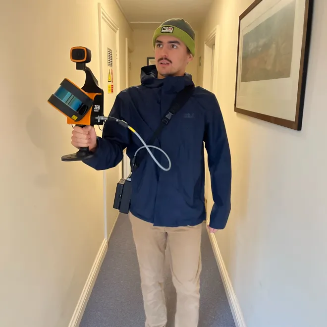
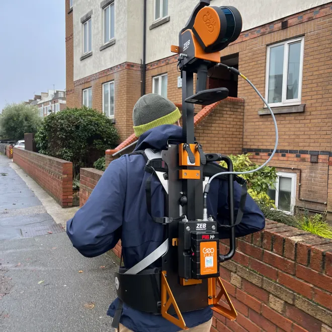
The handheld scanner we use doesn't restrict our access during indoor scans, and with the included backpack we are able to mount it higher to conduct outdoor scans.
With an effective range of up to 100 metres, and sending out 300,000 points per second, the LiDAR scanner we use provides accurate measurements with as little tolerance as +/-3mm.
The included 360° mounted camera allows us to utilise photogrammetry in order to give vibrant colour to our point clouds.
Data Applications
- Digital records
- Tree surveys
- Topographical surveys
- Planning
- VFX (films, tv, games)
- 3D rendered environments
- 3D modelling
- Surveys
- Environmental conservation (forests, caves, rock faces)
- Forensics (crime scene reconstruction)
- Archeology